NOTE: This definition of LOS also includes the nonstraight-line
propagation resulting from the refraction (bending) properties
of the Earth's atmosphere.
b. LOS Procedures. To plan a signal path for an LOS radio and/or
radio relay link, follow the procedures listed below.
These
procedures apply to planning each link in a system of interconnecting
or parallel paths.
(1) Based on your determinations made in your site selection
process, identify the exact terminal sites.
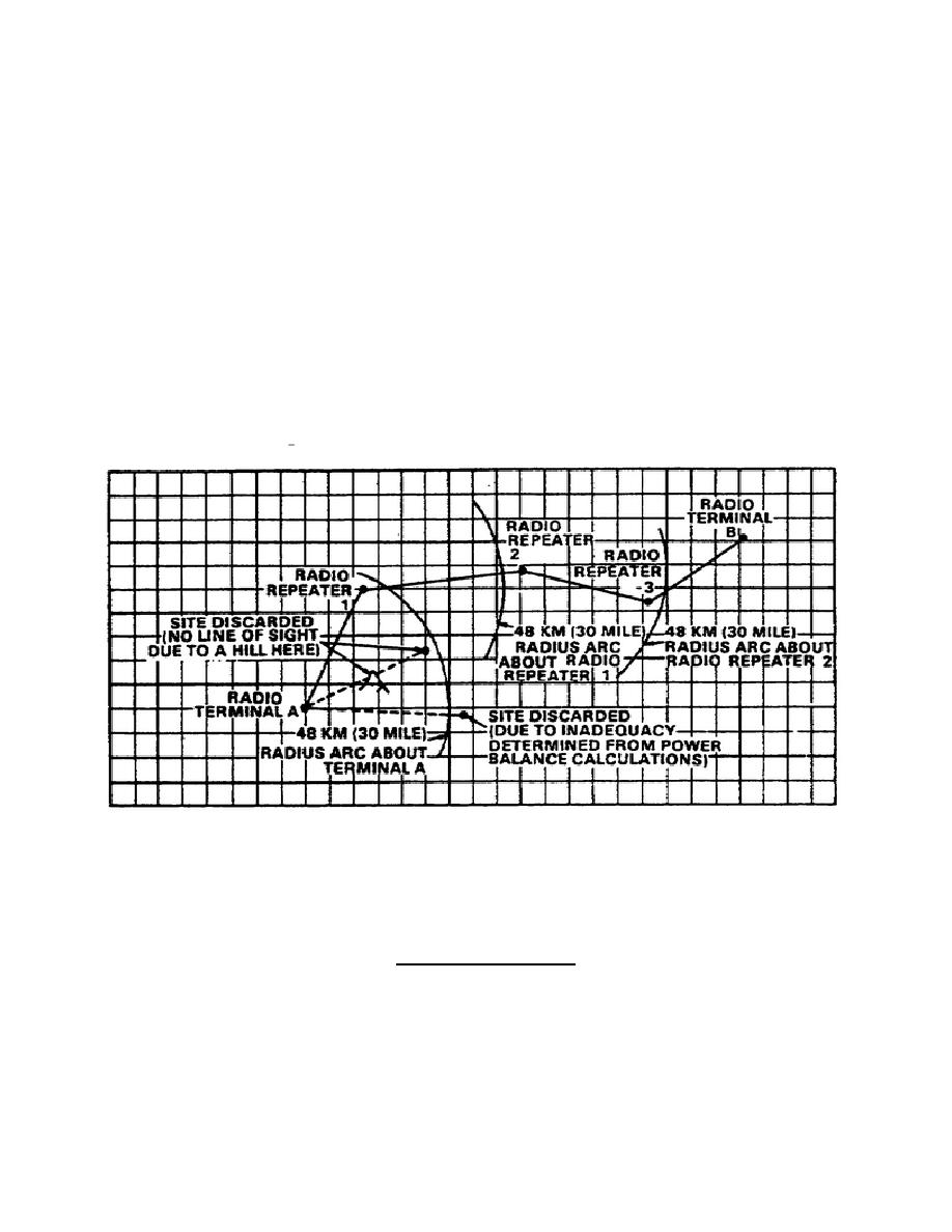
(2) Draw a sketch on paper of each radio system.
Label the
terminal at the higher headquarters, point A; and the other terminal,
point B. See figure 2-4. Draw an arc with a radius of 30 miles from
point A.
Figure 2-4.
Selection of radio sites
NOTE: Use of a contour map aids in the identification of possible LOS
paths since contour lines are easily evaluated.
(3) On or near the 30-mile arc, choose a site with a high
elevation. Label this site Radio Repeater 1.
(4) Draw a profile graph of the ground between terminal A and
repeater 1. Using the procedures described below, determine whether
an LOS path exists.
2-10
SS0016


 Previous Page
